Monday, April 13, 2026

10 Great Things to Do in Patagonia for an Unforgettable Adventure


Sprawled across the southernmost tip of South America, far away from the cramped and entangled cities of North America, lies Patagonia. It’s a big unspoiled wilderness, an antidote to urban life, and, unless you’ve lost your senses entirely, or your last sliver of curiosity, it will captivate you. Monstrous glaciers, spectacular and unique wildlife (condors to guanaco), towering Andean peaks that run down the region’s spine, and on either side its endless pampas and shimmering lakes. If you want heat, Patagonia will deliver that, or bitter cold, and winds that will knock you sideways.

You can hike the world-renowned Torres del Paine National Park, marvel at the imposing Perito Moreno Glacier, or lose yourself in the wild serenity of Tierra del Fuego, a land Charles Darwin explored 150 years ago. And, if you’re up for it, there are plenty of exciting ways to get well off the beaten path: kayaking, white-water rafting, horseback-riding, week long hikes into the wilderness, even ice-climbing on Patagonia’s glacier fields. It’s an enormous place that spans two nations and reaches to the South Ocean and some of the most ferocious seas on earth. All you have to do is get there.

I first entered Patagonia from the northwest, heading from Peru to make my way down Chile’s coast to the town of Puerto Montt.  There I had booked passage on a ferry called Navimag that would take me to Puerto Natales, Patagonia’s southern gateway. I had heard about it during my cruise from Miami to Lima over dinner with an inveterate traveler named Mike, a man who had already scrambled into and around 100 of Earth’s countries.

For five days Navimag coasted me, my wife Cyndy and about 100 other truckers, sailors, travelers and locals through the vast archipelago. I had never seen any part of the world that looked like this — the sea, immense mountain islands, fiery sunsets, a luminescent full moon, all as majestic as anything earthly could be. I struggled to hold it all in my mind because I knew no words could ever do the experience the remotest justice. In one stroke I realized how fortunate I was to witness this, and how sad to know I would leave it behind.


Patagonia still feels like a frontier, even as its few cities are slowly encroaching upon the wilderness. Sheep roam the steppes nourishing the wool industry that has long been the backbone of the economy, guanaco lope freely, condors arc and sweep across the broad sky in search of dinner, and if you’re lucky enough you may come across a pride of wary Puma. There is history too. Ancient native peoples — the Tehuelche, Yaghan, Ona, Haush and Alacaluf — thrived in these wild places for millennia before the expeditions of Juan Diaz del Solis, Magellan, Robert Fitzroy and others wiped them out. Descendants of these native people, their names and heritage nearly forgotten, now blend into a population of ethnic German, Croatian, English, Criollo, and Mestizo peoples.

Patagonia’s beauty, history and isolation, of course, are the very forces that are expanding the region’s tourism so if you are looking to get off the beaten path, make your move now. Unplug, find solace in the vastness of this place and marvel at its profound silence and unspoiled beauty … at least when the winds aren’t howling.

Here are ten great ways to do it …

1. Lose Yourself in Torres del Paine National Park

The crown jewel of Patagonia. Named for its three famous blue towers the Torres claw their way out of the earth and swallow the sky. The mountains are 60 million year old, igneous rocks that emerged when the magma chamber below bulged upward cooling into a gargantuan hump. The advance and retreat of glaciers over the eons created the immense beasts we see today. They are the sine qua non of Patagonian exploration. Along with the glaciers, valleys, lakes and rivers that surround them, the towers are so big and powerful they generate their own weather.  Together they offer all the adventure you need. Hiking, climbing, horseback riding, kayaking, and more!

Other highlights include Gray Glacier, Cuernos del Paine, and Lake Pehoé. You could easily spend weeks exploring the park. Wildlife lovers will enjoy the guanaco herds grazing on the plains and soaring condors floating on the mountain’s thermal winds.

For visitors there are many available hikes through the park, both leisurely and brutal. Those with time on their hands should consider the O Circuit, a 6-10 day adventure looping around the Cordillera del Paine. This is a challenging hike across 66 miles (110 km). The W Trek is the most popular portion of the O Circuit, taking about half the time to traverse. The W can even be completed without food or equipment, taking advantage of the many campsites along the route.

The Hosteria del Torres is a charming place to stay. There is also the Grey Lake Hotel. For food, consider the Pampa Lodge, Hostería del Torres or Grey Lake.

2. Cruise Tierra del Fuego and Stand at the Tip of Cape Horn

The archipelago across the Strait of Magellan is the southernmost tip of South America. Shared by both Chile and Argentina, the island chain has been inhabited for over 8,000 years. But here, today, the land is nearly empty. This is truly the definition of nowhere, but it’s not easy to get there. Australis operates a five day expedition from Punta Arenas through the islands, pausing to visit some of the most stunning and remote places on Earth. This is where a young Charles Darwin cut his teeth on evolutionary science and the region is filled with stories of adventure and death, from interactions with the native Yahgan and Fuegian people and hair-raising nautical adventures experienced by the likes of Sir Francis Drake, Ferdinand Magellan and Ernest Shackleton.


Australis Zodiacs take hikers from the ship to wild sites that very few people have seen, including a hike to Cape Horn (weather permitting), the southernmost bit of South America. Standing by its single red lighthouse you can imagine Magellan’s fleet sailing past, led by Trinidad. The weather is cold, rarely higher than 45°F in the summer. You won’t find much at the Cape, but visitors will see a tiny chapel and functioning lighthouse and a battered metal sculpture to visit. Enjoy the 270 step hike to the Horn’s highest peak. Unfortunately, the native Yaghan people are gone. Aside from a few Chileans, visitors will only encounter the people you’ve met on the cruise.

Another Australis highlight takes passengers through Glacier Alley fjord offering magnificent views of five tidewater glaciers extending their great tongues of ice from craggy valleys to the waters below.

3. Ferry on the Navimag

Navimag operates a round trip ferry system through the Chilean fjords between Puerto Montt and Puerto Natales. This is transport for both locals and serious travelers. The riders hail from all around the world on weeks and month-long excursions to discover some of the most remote locations in the world. These ferries curate a collection of books and movies which, along with shipboard activities, can teach you about Chilean history and culture. Multilingual guides are onboard during the high season from October to April. There’s a charming little, glass-enclosed lounge for reading, daydreaming, conversation and beverages. A great place to pass the time, but not too much. You want to be outside as much as possible.

I enjoyed the cruise on Navimag’s newest vessel, Esperanza, with room for 244 passengers in spacious, but spartan accommodations. The cabins are shared among four or more riders, but two can buy out the whole cabin at a reasonable price. Common activity space is limited. You’ll find a not terribly usable gym, yoga room, and the lounge. Food is served cafeteria style three times a day. It’s good and there’s plenty of it, but it’s the conversations you have at the big tables while eating that are the real bonuses.

The ride is usually four days, but it took five when I made the trip. Sustained winds of 40 mph made it impossible for the ship to wrestle its way to the harbor so we anchored an additional full day. This is not uncommon for this voyage so make sure you have a flexible schedule. Riders can count on Patagonian winds to keep them alert across 10 degrees of southern latitude: 41°S to 51°S. That’s the origin of the saying, “Below 40º (of latitude) there is no law. Below 50º there is no God.”

4. Take a Hike Above Laguna Sofia

Laguna Sofia is about 30 minutes from Puerto Natales and you can reach it via a brand new highway. It may be one of the most underrated destinations in Patagonia. On this day-trek, you’ll climb several hundred vertical feet through grass and trees into scree to a promontory high above the lagoon. Beyond that lay rocky cliffs and snow-capped mountains in every direction. You might even be lucky enough to see a condor perched nearby. The winds, as usual, are out in force, powerful enough to knock you over. A side bonus: unlike other hikes in the Torres area, you can usually expect this one to be deserted.

5. Explore San Carlos de Bariloche

San Carlos de Bariloche is a charming tourist town with a striking resemblance to the Swiss Alps, tucked along the immense and pristine alpine lake Nahuel Huali. If you’re entering Patagonia from the north, Bariloche is a spectacular way to do it. Enjoy it for its scenery, hiking, winter skiing and upscale amenities. Besides the Alpine feel, the town itself underwent a tourism renaissance in the 1930s that added Swiss architectural touches to the town’s architecture. Even its chocolate is famous.   

The region has a strange history too. Bariloche was a refuge for Nazis escaping Europe following World War II. Argentine president Juan Péron was a known Nazi sympathizer who courted European dictators. One legend has it that Hitler faked his death and fled with Eva Braun to Bariloche.

6. Tour Ushuaia

Long regarded as the worlds southernmost city, with protestations from its much smaller Chilean neighbor, Puerto Williams, Ushuaia, also known as the “End of the World” is the capital of Tierra del Fuego province. Dress warm. The climate is an ocean moderated sub polar mild tundra; just a fancy way of calling it “cold.” If you’re looking for counterparts, think of Anchorage, Alaska, Reykjavik, Iceland, and Nuuk Nuuk, Greenland. But don’t let this keep you home.

Ushuaia’s breathtaking landscapes rival any on Earth, with snow-capped peaks, pristine glaciers and sparkling fjords surrounding the city. And it’s the launch point for adventures throughout Tierra del Fuego and beyond. Tierra del Fuego National Park, Martillo Island, and the Beagle Channel are reachable by ship. For those who love winter sports, this is your place. Skiing and ice hockey are immensely popular. The ski resort at Cerro Castor has the longest season in South America, thanks to that sub polar climate.

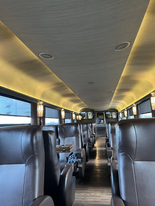
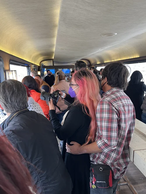
The End of the World Train takes visitors from Ushuaia on a two hour scenic tour of Tierra del Fuego National Park. The steam railway once transferred Ushuaia’s prisoners into forests where they harvested the lumber that built both the city and the prison in which they lived, the original reason the town was created!

For food, visit warm and vibrant La Parrilla Restaurant, famous for its flame roasted lamb. Hosteria Restaurante America is a good mid-range option for lodging, but if you want more upscale digs, consider the Albatros Hotel.

7. Visit Cueva del Milodón Natural Monument

The huge Mylodon sloths, enormous beasts up to 12 feet tall that roamed the Patagonian landscape thousands of years ago, were the inspiration for Bruce Chatwin’s famous book, In Patagonia. Mylodons’ and their hairy coats were first discovered and cataloged by Darwin during his time with HMS Beagle. Although mylodon extinction is attributed to multiple factors, their disappearance also coincided with the arrival of certain two-legged pack hunter 11,000 years ago.

Cueva del Milodón is located near Puerto Natales. It is not a single cave, but a complex of three, each with a different character. The largest and most popular, Cueva Grande, is impressive for its size and its notoriety for Mylodon preservation. Equally compelling, for different reasons, are the other caves. Cueva del Medio sheltered humans over 11,000 years ago under a less forgiving climate, while the third cave, Cueva Chica, is deeper and darker than the other two. Spelunkers will enjoy exploring Chica’s nooks and crannies.

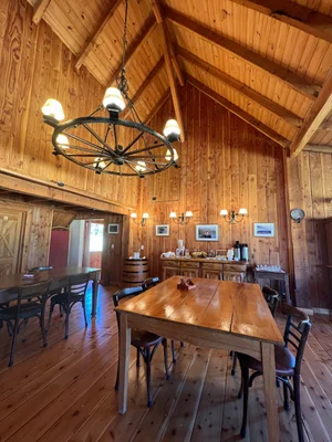
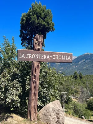
8. Hunt Down Butch Cassidy’s Ranch

Butch Cassidy and The Sundance Kid is a classic American western tale (and Oscar-winning movie). Outlaws Butch Cassidy, Harry Longabaugh and Etta Place, strike it rich ripping off banks and trains in the Western United States until a special posse is sent to hunt them down. They collect their loot, escape to the remote South American plains and buy an 800 acre ranch, determined to go straight. For several years they do, but then they are found out. They sell the ranch and eventually (after Etta departs) the bank robbing begins again. Their fate isn’t as clear as the movies might tell you, but their Patagonian estate in Cholila, just a few hours from Bariloche still stands and is a fine place to explore. So is the bar just a half mile from the bandits’ old house, filled with fascinating paraphernalia and excellent beer and empanadas.


9. Hike Los Glacieres Parque Nationale

Most of epic Patagonia can be experienced from the Chilean side of the Andes. But this Argentinian gem is an exception. Los Glacieres is an immense ice field, one of the largest in the world, feeding hundreds of glaciers throughout the region. The geography has created two distinct areas for adventurers. To the north are the Viedma lake and glacier, along with Mount Fitzroy and Cerro Torre, popular for hikers and climbers. Perito Moreno Glacier, one of the most popular attractions in Argentina can be found to the south, its channel draining into Lago Argentino. Perito Moreno stubbornly resists the warming trend that weakens its glacial siblings; gains and losses are in equilibrium for the time being. Visitors can join tours, ride horseback, camp, fish, and more.

10. Bust a Bronco in Cerro Castillo

You’ll recognize Cerro Castillo by the towering sculpture of a rearing horse at the big roundabout on the town’s outskirts. Perhaps its proximity to Torres del Paine is the reason, but this town has its own western charm. It has a long history in the wool shearing trade that remains a big part of the economy. Mule trains once carried wool across the pampas to Puerto Madryn. The town is also famous for its annual bronco busting horse festivals, called “Jineteadas.” The Jineteadas are divided into several parts throughout the year, one each weekend per month from December to March, where the local gauchos, Patagonian cowboys, compete. Time your visit accordingly to catch one of these great events.

There aren’t many places to stay, but we enjoyed the modest Riverline Lodge. Cozy rooms and a fine local restaurant.

Video - John Fedele

Explore Further

Read about the extensive travels of my Vagabond-Adventure through Patagonia in the Vagabond Journal and our journey around the world traveling all seven continents, never by jet, at Vagabond-Adventure.com.

For more suggestions, including additional information about the services and experiences throughout Patagonia, visit our Patagonian Recommendations. Recommendations are updated frequently. Leave any questions in the comments below or contact the Vagabond-Adventure to learn more. Travelers looking for expert guidance will want to contract with a local expert. I am grateful for the services of Luciano Galvez Martinez who did a wonderful job helping us through this vast land. He grew up in Puerto Natales, speaks excellent English and immensely knowledgeable.

Resource: https://vagabond-adventure.com/library/exploring-patagonia-ten-great-ways-to-experience-patagonia-with-recommendations

Tuesday, April 7, 2026

Antarctica Expedition Ice, Wildlife & Southeren Seas

 Embark on an unforgettable Antarctica expedition, exploring vast ice landscapes, encountering penguins, seals, and whales, and cruising the Southern Seas. Experience pristine wilderness, dramatic glaciers, and breathtaking scenery in one of the world’s most remote and awe-inspiring destinations.

See more: https://vagabond-adventure.com/vagabond-journal/category/Antarctica


Thursday, April 2, 2026

The Roshi Khola, Nepal. Evidence of the summer monsoon

 Evidence of the summer monsoon—a season of extreme rainfall—remains visible along the BP Highway. This surge reclaimed the land, sweeping away sections of the roadway and nearby structures. It is a stark look at the fragile balance between critical infrastructure and the power of the natural world.


See more: https://vagabond-adventure.com/


Monday, March 9, 2026

Exploring Morocco’s Northern Gems: Tangier, Tétouan & Chefchaouen


Day 244 - May 28, 2022 – Tangier - Day 1

There are at least ten theories about the origin of Tangier’s name, but my favorite comes from the ancient Greeks who called it Tinjis, a daughter of the Atlas, the titan who supported the vault of heaven near the Gibraltar Straits. Under the Romans the name morphed to Tingis then developed into the Portuguese Tânger, Spanish Tánger, and French Tanger, where it entered English as Tangier and Tangiers. The Arabic and modern Berber name for the town is Ṭanjah.

I love name origins. Don’t ask me why.

On our first full day in the city we walked out the door of the El Minzah Hotel (see Dispatch XXVIII - The Mysteries of Morocco ) to a beautiful day: 70° with a predicted high of 84º. A sweet breeze out of the Mediterranean and not a cloud.

The night before we had prowled the nearby streets filled with Tangerians walking with their children and enjoying the view above the sea. Clusters of young people milled and joked, teasing and flirting the way teens do. Cyn and I found a cafe with Parisian style awnings and small round tables inside and out. The place was brimming with men, smoking, drinking coffee (alcohol is not part of the Islamic experience), discussing and debating in rapid Arabic. There was not a woman to be found, and Cyndy stood out like a rabbit among wolves. But the waiter was kind and we detected not an ounce of misogyny.


Tangier is everything I imagined. Vibrant, but not crammed. Old but not dingy, with the sounds of Arabic music, French conversation, Spanish voices in our ears as we passed scrumptious Moroccan bakeries filled with baclava and tiny, fresh pastries that your palette knows will go perfectly with a cup of hot mint tea — a Moroccan speciality.

The city sits above multiple hills and when standing on one of the them the view of the Mediterranean and the city’s sweeping bay made me feel that, yes, I really was somewhere other than home; somewhere exotic, marinated in history. It was a place I could stay for a long time.

Back in the 1930s, the expatriate writer and composer Paul Bowles thought he was coming to Tangier on a lark. He never left. “I relish the idea that in the [Tangier] night,” he once said, “all around me in my sleep, sorcery is burrowing its invisible tunnels in every direction, from thousands of senders to thousands of innocent recipients. Spells are being cast…” There was something to that. To me Tangier fell in with that small group of international cities that were once entirely independent, a city-state, unencumbered by the nations that surrounded it: Trieste, Monte Carlo, Ephesus, Alexandria. Cities like this take on a flavor and confidence that is more cosmopolitan than most. Bowles called it the navel of the world.

As much as Bowles loved Tangier, he adored travel just as much. While we were exploring the American Legation, I caught another quote of his that captured precisely the attraction that world travel has for me. “I feel that life is very short, and the world is there to see, and one should know as much about it as possible. One belongs to the whole world, not just one part of it.”

We had found our way to the Legation — now officially known as the Tangier American Legation Institute for Moroccan Studies — by way of Tangier’s winding medinas. It and Morocco go way back. Morocco was the first country to officially recognize the United States when Sultan Mohammed ben Abdallah issued the proclamation on December 20, 1777 clarifying for the world that the U.S. was no longer a British colony.  The Legation building was gifted by the sultan to the U.S. government to serve as a diplomatic post, and it remained there for 140 years from 1821 to 1961. It was the first American property to exist outside the United States, and is the only U.S. National Historic Landmark in a foreign country.


The American Legation in the middle of Tangier. Morocco was the first country to accept the United States as a nation, not a colony. 

Later in the day, Youssef, our guide, led us through the part of town where local looms turned strung wool into fabrics of all kinds — pillow covers, blankets, rugs and wall hangings. These looms are the pre-industrial variety where wool threads of different colors are strung through the loom one by one. It is hard work, but the results are rich, colorful and unique.

Local looms turned strung wool into fabrics of all kinds.

But that wasn’t until after we first toured the city’s Portuguese battlements where we got an eye-popping view of the straits that sweep in a great white and blue arc along Tangier’s coastline.

Not far away we found a newly built museum dedicated entirely to Ibn Battuta, one of the world’s truly great travelers, at least if you read his remarkable book, A Gift to Those Who Contemplate the Wonders of Cities and the Marvels of Travelling, more commonly known as The Rihla. The museum is a beautiful, multi-story building with an open courtyard and excellent interactive descriptions of the man’s journeys. Battuta was born in the 14th century and departed Tangier on 2 Rajab, that’s the Muslim year 725 Anno Hegirae, or by the western calendar, 14 June 1325 AD). A descendant of the Lawata Berber tribe, Morocco’s native inhabitants, he was twenty-one when he set off on a pilgrimage to Mecca. Normally that would have taken sixteen months. Battuta didn’t return again for 24 years.

Abu Abdullah Muhammad ibn Battutah - Was he the world’s greatest traveler?

“I set out alone,” he wrote, “having neither fellow-traveller in whose companionship I might find cheer, nor caravan whose part I might join, but swayed by an overmastering impulse within me and a desire long-cherished in my bosom to visit these illustrious sanctuaries. So I braced my resolution to quit my dear ones, female and male, and forsook my home as birds forsake their nests. My parents being yet in the bonds of life, it weighed sorely upon me to part from them, and both they and I were afflicted with sorrow at this separation.”


It’s arguable Ibn Battuta travelled more than any other explorer in pre-modern history, 73,000 miles (and never by jet :-). He passed across northern Africa, deep into Egypt, explored most of the Middle East, headed into Persia, then north into Europe and East toward India and China. If true, his odyssey would have out-explored other great wanderers of the era like Zheng He , Marco Polo and Leo Africanus. Not all scholars agree that Battuta made everyone of these journeys, especially into eastern Europe and the far East. He apparently never kept notes and when he wrote his famous book after decades of travel he very likely fictionalized some encounters and plagiarized others. But even if he did, his book leaves a remarkable record of what much of the known world was like almost 700 years ago.

Near Ibn Battuta’s museum we heard a man playing his Oud, an ancient eleven-string Moroccan instrument, a kind of cross between a balalaika and guitar. We sat with him in a small, room off the square, shared some mint tea and watched his fingers fly over the strings. Big black glasses hung on his weather face. He didn’t speak a word and except for his fingers he hardly moved. He and the instrument were locked, two symbiotic creatures, each needing the other; each better together than apart.

A man plays the Oud near Ibn Battuta’s museum.

Early afternoon — Youssef sat us down for our first Moroccan meal together in a small cafe. We ordered and dug into tomatoes and olives and beets, calamari, and chicken tangine, and shrimp using khobz, coarse Moroccan bread, to place the food in our mouth instead of forks and spoons. It was all delicious. Moroccan cuisine is considered by many to be among the world's finest, and Cyndy and I weren’t going to disagree.  We had already witnessed  delicious food our first afternoon at the Diblu Restaurant, but with every meal the food only seemed to get better. Moroccan cooks specialize in spices, lots of them, including ras el hanout (a blend of 10 to 30 spices), coriander, cinnamon, cumin, saffron, dried ginger, and paprika. The combination of these flavors makes all the difference, IF you get them right.

Tangines are among one of Morocco’s more spectacular culinary gifts — stews of roasted lamb, fish or chicken with vegetables and spices of all kinds cooked in a cone-shaped terra cotta vessel that gives the meal its name. But you’ll also come across couscous with raisins or nuts and Harira cooked in a thick, tomato-based soup with chickpeas and meat traditionally served during Ramadan. During our explorations of the country, we found that every sector has its own specialties. But no matter where we ate, every meal was excellent, and healthy.

Day 246 May 30th 2022 – Asilah - Day 3

Food was still on our minds in the morning when we watched one of the cooks at the El Minzah making pancakes called msemen or rghaif, a kind of crepe you’re meant to enjoy for breakfast after you’ve rolled it with chocolate, honey or butter. One more delicious Moroccan concoction.

A cook at the El Minzah making pancakes called msemen.

That and some coffee and we were off to meet Jebriel and Youssef and head east toward the old town of Asilah where the Mediterranean Sea meets the Atlantic ocean. White beaches darted with colorful little umbrellas ran along the sandscape, but there was hardly a soul around except for a few teens enjoying the water.

Asilah is not far from Tangier and is famous as another fortress expanded by the Portuguese in its hey day, this time after it took the city in a massive sea assault in 1508. The fort is enormous and I could see the proof that Portugal had once been one of the world’s most formidable nations with a massive navy, a global trading system and colonies that extended from South America to the Far East. They remained formidable until the earthquake and tsunami of  1755 struck Lisbon and decimated the empire.

The ancient fortress city of Asilah where the Mediterranean meets the Atlantic Ocean; a city lost in time; old double door knockers and local tapestries and artwork. (Photos - Chip Walter)

Though the fortress still stands at the edge of the sea, Asilah now is a tiny town made of walled and winding buildings hundreds of years old, a step back in time. The streets are narrow and both donkeys and the locals use them to navigate their way around. We walked past doorways with big wooden doors surrounded by high adobe walls. The doors, Youssef explained, usually have two knockers. One, larger and higher up at the center of the door and a second that was lower somewhere to the side and smaller. They existed to let people know what sort of person was knocking. Children and women generally clapped the smaller knockers and men usually wrapped the taller ones.

We were wandering the streets and the ancient battlements when I saw a man working inside the basement of one of the buildings. He stood at a big brick oven inside a floor of dirt, taking patted cakes of dough and passing them with a wooden paddle into the oven. He was making khobz, a grainy wheat dough patted with olive oil. Together they create a delicious soft crust as it is slow cooked in the stone oven. I bought a couple and we ate them fresh and hot right out of the oven. If only I could have gotten my hands on some tangine.


Making khobz, a grainy wheat dough patted with olive oil.

Later, we drove back toward Tangier. High hills rose up from the outskirts of downtown. It looked to me like the city was thriving. I checked. Its population is growing — pushing  1.3 million people in the metropolitan area.  I saw new rectangular houses and apartments outside on the city’s outskirts that reminded me of the Mediterranean-style apartments that are crowded everywhere in Athens - cement, square, awninged, brilliant white. In between were older homes where small balconies hung above tiny yards strung with sheets, shirts and dresses that furiously flapped in the dry wind. The people in this little sector of the human race were still living their lives not all that differently than Carthaginian laborers, or plebeians under Rome or sailors who had moved from Portugal or fleeing jews from Spain had in years and centuries past. Looked at the windows as we passed. Each had their own story. Each their own dreams, hopes, joys, sorrows and fears. And every day, the city itself evolved, powered by it all.

Day 247 - May 31st 2022 – To Tétouan, Chefchaouen and Fez

First thing the next morning, fortified with fresh msemen and apricot jam, strong Moroccan coffee and papaya, watermelon, pineapple and kiwi, we and our bags left Tangier behind and began winding by car to Fez, one of Morocco’s largest cities and the nation’s religious capital. Its history dates back 1100 years. But first we would stop by Tétouan, renown for its culture and art and one of Morocco’s many UNESCO World Heritage Sites. After that onto Chefchaouen, Morocco’s famed Blue City, also a UNESCO site. (Morocco has nine of them.)

Tétouan

Tétouan is a city of over 300,000 people that lies in a broad, brown valley that skirts the Mediterranean. Nomadic Berbers settled here, though it’s not precisely known when. Historians only know it was before Phoenician traders showed up 2900 years ago. For awhile, it was part of the Carthaginian empire until Romans arrived in the 4th century B.C and made it a colony under Augustus. The Berbers didn’t care for that and eventually drove them out of the nearby Rif mountains.

Many of the people in Tétouan still speak Spanish, partly because thousands of Spanish jews migrated to the city during the Spanish Inquisition in the 16th century when, under Catholic rulers Ferdinand and Isabella and the Spanish Inquisition, Jews were tortured, forced to be baptized Catholic or exiled from all lands controlled by Spain. The city is still sometimes nicknamed "Pequeña Jerusalén," Little Jerusalem.

Ironically, Spain itself came to control this part of Morocco when in 1913 it became the capital of the Spanish protectorate of Morocco. It remained the capital until 1956, when the region regained its full independence, another reason most Tétouans speak Spanish. It was here in this enclave that Francisco Franco raised his army, brought it in 1936 to Spain where he eventually took control of the country and ruled for nearly 40 years until turning it over to a new monarchy under the current king, Juan Carlos.

Despite its long Spanish history, Tétouen itself looks Moroccan down to its toes with its adobe buildings and broad, oak-lined boulevards. We weren't allowed to take pictures in the souks (marketplaces) but we navigated the tight alleys past cyclists, locals dickering over goods, and donkey-pulled carts, as we eyed the labyrinths of fresh fruit, open bowls of spices, iced fish, meats of all varieties, baskets of apricots, tomatoes, nuts, garlic, onions and carrots — all of it fresh and displayed beautifully by the family members who have been running the businesses here from the time in memorial.

“Through here come women who prepare the days meals,” said Youssef, “with fresh, local produce, meats and fish, herbs and of course pastries made with fresh dough, nuts and honey. It all sounded delicious to me, but time was short and we wanted to explore the city’s intimate Anthropology Institute because the relics inside date back to King Juba II, 200 BC, and later mosaics, sculpture, pottery and metal work, under Quito the Roman head of the region. I particularly loved an ancient sculpture of Hercules battling the titan Atlas.

With a few hundred years of ancient history crammed in my head, it was time to get to Chefchouen. Our car swung us away from the valley into the green hills that rose into the Rif mountains, ears popping. Soon were were passing through small, rolling farms of corn and peas and olives orchards winding generally south.

Chefchaouen

Chefchoan is indeed blue. You can see the village from a mile away, its adobe buildings clinging to a steep hill that rises above the flatlands below. We parked on the periphery and walked along the creek that flanks the east boundary of the town.

Everything about Chefchaouen is refreshing: the deep blue, sapphire, azure, lapis colored buildings and steps; the cold, gurgling creek where a local entrepreneur surrounded by every imaginable fruit expertly sliced chunks of chilled watermelon for us, singing a quiet song while he worked; the countless art galleries, woven tapestries and paintings that hung all around us until we reached the town plaza and the location of the old Kasbah and prison, built to keep Portuguese invaders at bay. Along with the Ghomaras of the region, and the Moriscos and Spanish and Portuguese Jews that settled in Morocco during the Spanish Inquisition, they fought to keep the Portuguese to the north. Ultimately they succeeded.

The Kasbah of Chechaouen functioned as a residence, arsenal, and this dreary prison.

Like Tétouan I could have spent days languorously exploring this intimate village, but we were on a schedule and I could only tag it as a place we would have be sure to return to some day. After another fine Moroccan lunch outside above the quiet square, we departed the Blue City and wound more deeply over and through the Rif mountains, past acres of olive orchards that Youssef explained are valued for the salty tang that makes its way from the sea-tainted ground into the olives you eat.

We drove for five hours through this country. Occasionally I would see a cluster of laughing children in a small village as we passed, or silos of grain, once a mule with a rider holding an enormous bundle of sticks precariously on the animal’s back. I'm not sure what sort of geography I expected to see as we passed through this part of Morocco, but it wasn’t the beautiful rolling landscape I was looking at. I felt at home, at ease, grateful.

Morocco’s salt-tanged olive orchards south of Chefchaouen. 

Still, after the long drive, we were happy to see the broad, low buildings ahead, the outskirts of Fez. We passed beneath a long, palm-treed boulevard and then bent toward the old city’s immense ramparts until at last Jabriel and our car took us through them and into Morocco’s holy, Islamic city and then to our rhyad hidden deep within the city’s labyrinthine medinas.

Resource: https://vagabond-adventure.com/library/exploring-moroccos-exotic-cities-tangier-tetouan-chefchaouen

Friday, March 6, 2026

Day 774 Of Vagabond Adventure

 Patan Durbar Square. Across the Bagmati River in Lalitpur. Still standing. Still active. Still lived in.


Wednesday, February 25, 2026

Everything You Need to Know Before Walking the Camino de Santiago


When you travel the way we are, without the use of any jets, you stumble across places that don’t show up inside the Rick Steves or Frommer travel books. Vigo, Spain would be an example of that. It’s is a gem of a mid-sized city along the Atlantic Ocean just north of Portugal that also happens to be on one route of the famous Camino de Santiago, also known as the Way of Saint James or El Camino, the holiest and most popular of all Catholic pilgrimages in Europe. Given its importance, we knew we had to walk it. Part of our goal as we travelled the planet was to trek as many pilgrim trails and holy places as we could — Buddhist, Hindu, Muslim, Christian.  Not that we knew much about the Camino Way, except a few insights from Wikipedia.  If we were going to go, Cyn and I agreed that we might want to do some research.

It’s not easy to describe the Camino Way because it isn’t really one, single pilgrimage trail that leads from point A to point B. It is a whole array of ways, more akin to the junctions and pathways of the human brain spread out all over western Europe with some tendrils linked to the Middle East where St. James, the Apostle of Jesus Christ, was beheaded. You can therefore tread over any number of Camino Ways. The main thing is that in the end you make it to the apostle’s grave.

St. James - Peter Paul Rubens

James was a first cousin of Christ and, along with Peter and John (James’s younger brother), considered Christ’s favorite. After Jesus was crucified, James made a point of spreading the word about his cousin’s remarkable story and beliefs, and at one point made his way clear to a Spanish port now known as Camino Finisterre, a cape beyond Santiago, meaning “the end of the world,” literally; a place where the craggy igneous rocks of the north Spanish coast meet the thundering waves of the Atlantic Ocean. (We visited there later and it surely did look like the end of the world, but that’s another story.)


St. James had also apparently spent time in a little village nearby eventually given the name of Santiago de Compostela and the locals developed an affection for him. After James’s unfortunate death, the story goes that his disciples brought him back from Jerusalem to the place they felt he loved most. The name Santiago comes from the Latin genitive Sancti Iacobi, “the church or sanctuary of Saint James” and evolved through Portuguese into Sanct-tiago, from its derivatives Diego/Diogo. Now, more than two thousand years later, a massive cathedral sits over the saint’s simple grave, and during that time millions of saints and sinners, beggars and kings, even Charlemagne himself, have walked the Way of St. James in all of its iterations.

Anyone can walk the El Camino any time he or she likes and after we poked around at a Spanish map, we decided Vigo would make an excellent place to begin. It was one of the shorter routes — 100 kilometers, a 60-mile hike along the far western edge of Spain, and it was just north of where we were at the time in Portugal.

First job, get from Portugal to Vigo.

Getting to the Beginning

Through much of June we had been working our way from southern Portugal north with stops to Porto, Braga, Nazarre, Fatima and Aveiro, known as the Venice of Portugal. We had now settled briefly in a lovely beach town called Costa Nova, which seemed to have dropped like a gift out of the sky. Its huge sandy shoreline was as empty as nuns in a brothel, and we loved its striped homes, quiet streets and cool breezes. We set a July 4 deadline, which made it time for a return trip to Porto there to deposit our rental car at the Campanha Railway Station and hop the 7:10 PM train to Vigo. Once aboard, the train rattled and screeched us north on rails that would take us just a hair beyond the Portuguese border. We passed small homes, with their orange terra-cotta roofs and then as the sun dropped over the Atlantic threaded our way through hills of pine, peach, eucalyptus and towering birch trees that danced in the stiff evening wind.

It was dark when we made the half mile walk to the Hotel Atlantico, our home for the next few days. Behind the hotel desk we found an elderly man with thinning hair and the serene face of a Capuchin monk who signed us in. He moved with the speed of a tombstone, or maybe it was that after the day we had had we simply wanted to get immediately in our beds. But there is always the credit cards and passports and the mangled interlocutions of unfamiliar languages and, inevitably, “how long are you staying.” By now it was now 11 PM. But once in our comfortable room, “nature’s soft nurse” as Shakespeare put it, had us soon snoring away.

Camino de Santiago Packing Tips, Preparations and Camino Way Credentials

We spent the next two days prepping for our self-guided tour of the El Camino. We needed to re-provision basics like shampoo and deodorant and figure out the bare minimum we would need. Then there was the problem of transferring our excess baggage while we trekked the pilgrim trail. I wanted to investigate new shoes too. We were looking at walking an average of 10 miles a day on our 60-mile hike.  (I didn’t buy the shoes until AFTER we arrived.) And we needed our “passport,” our El Camino credentials. Nearly anyone who walks the El Camino carries this piece of paper that can be stamped at villages, restaurants and hotels where you stay; proof you truly made the spiritual pilgrimage. Generally, you picked these little pamphlets up at a local catholic church.

Luckily, there was a cathedral directly across the boulevard from the Hotel Atlantico. Cyndy and I crossed the street three times to pick up our passport, but it wasn’t until the third try that we found the church doors open. Once inside I was fear-struck. But why? Was it my childhood as a catholic altar boy mixed with the dread and power of the enormous church inside that was the culprit? Hesitantly I walked to the sacristy door, certain that when I knocked a rogue nun would slap my wrist or shake me by the shoulders and waggle her finger at me for daring to invade the sacred privacy of the place.  But finally, I did knock on the big wooden door, very quietly.  Me, a heathen agnostic, fallen from the Church, wanting not a soul-cleansing journey to a sacred place, but nothing other than a credential for some personal adventure. I had interviewed Nobel Laureates, shaken hands with Henry Kissinger and met who knew how many celebrities, but here I was petrified.


The door opened. An elderly, kindly priest stood before me. He wore his cassock and collar. His hair was dark and thinning. He smiled at me. I stuttered out my purpose for being there in a few syllables of mangled Spanish. A two euro contribution was usually expected in exchange for the passport, but I only had one euro or €20. Did he have change? He gently waved his hand away. The money was unnecessary, and then handed me the “passport.” I felt right then that he must be the kindest man in the world, and thanked him far too many times. Outside I showed the piece of paper to Cyndy and grinned. I knew now that we were officially on "The Way."

Packed for six days of nonstop hiking. Everything a pilgrim could need.

Exactly how we would make our way along the Camino remained unclear since I could find no detailed map that pertained to our specific route. We only knew there were small towns and villages we would try to reach by day’s end. How we connected the dots was another matter, mostly left to our phones. The afternoon before departure, we did take the time to find the Vigo Trailhead and then we headed back to re-organize our bags. The Hotel had kindly agreed to let us keep most of our possessions with the two bags we normally carried everywhere in a locked room. All of the rest we stuffed like sausages into our little REI daypacks — a few pairs of pants, shorts and shirts, caps to protect us against Spain’s hot summer sun, power cords and enough toiletries to get us through six days and nights.  The next morning, we would head out and join the other millions who had made this pilgrimage.

We had no idea what was coming. But that’s the way it is with journeys. You never know what lay before you.

July 4 - On the Way and a Bagpipe

We walked out of the Hotel Atlantico, a full breakfast in our bellies, and headed north. Three miles in, on the outskirts of Vigo, we departed the urban pavement and the tan adobe houses and apartments capped with terra cotta roofs that surrounded us. Now it was only the crunch of sandy, rocky soil beneath our feet.

Brimming Garden near Vigo Estuary

On our right, we rose into steep hills brimming with small gardens; on our left the immense Vigo estuary, and its cargo ships anchored in the nearby waters. Once we crested the hill we found ourselves in a forest along a ridge high above the water. It was already 80º Fahrenheit, but cooler here. We could have been walking through the very woods that thousands had trekked 300 or 400 years in the past. We saw not a single sign of the 21st century. And then we heard the strains of a bagpipe. A bagpipe! Slowly the sound grew, and when we rounded a bend, there among the trees, near a babbling creek, we saw Maria, a young, dark-haired woman, cheeks puffed and fingers flying as she played a lovely Scottish melody. What the …!

Maria greeted us as though we were old friends and just happened to be passing by. She spoke excellent English with a Celtic lilt and explained the bagpipes. This part of Spain is known as Galicia, an area settled by early Celts even before the Romans showed up over 2000 years ago. (Galicia derives from the same word as Gaelic.) Celts ran this part of the world south to Porto and as far east as Léon. The bagpipe was an interesting musical move, I thought. Personally, I might have preferred a guitar or piccolo; a little easier on the ears, but the squawk of the old instrument made an undeniable statement. There was no mistaking it was Celtic because I have yet to hear a bagpipe anywhere else in Spain except in the arms of this uncommon woman. And for her part, it happened to be the instrument she knew best.


Beginner’s Rules for Walking the Camino Way - Avoid Blisters

We couldn’t spend too much time with Maria, delightful as she was. We had another 10 miles to cover if we were to make the little town of Arcade north of the estuary. So we gulped down some water, gobbled a handful of gorp and made a contribution to Maria before waving goodbye. A few more miles brought us down a wickedly steep paved street, back to sea level. That was where the blisters started. At first it began as a slight burning, but after descending several hundred vertical feet, I was pretty sure my right toe had caught fire. Luckily Cyn’s feet remained intact, at least for now. We walked through the small town, trying make sure we were following on the right path. This was not always easy. Sometimes you would see a sign that looked like the yellow rays of the sun against a blue back drop (often described as a clamshell) or sometimes simply a bright yellow arrow pointing you in the right direction. But here, passing through this village, we were back on urban streets and there was no sign to be found. We had seen some other pilgrims and followed them, hoping they knew their way around better than we did. My feet were scorched, and I had no desire to add to the day’s mileage.

In between creative ways to guide pilgrims, Cyn walks the 14 miles on our first day

I’ll spare you the details, but after another seven miles, through hills, cobble-stoned streets and the along a major highway where massive trucks whipped by in the afternoon heat (yes this was part of the El Camino too), we finally saw the edges of the small town of Arcade. We had both begun to feel we might never get there. The heat had wrung us out, our dogs were yelping and the blossoming blisters on my right foot felt as though they had been blow torched.

Thankfully, Cyndy had found a fine little restaurant/hotel in the center of town right across a tiny church where the statue of a medieval pilgrim stood, a reminder of our roots. Our pedometer showed we had walked 14 miles.

Nothing to your average Roman foot soldier, but it had decidedly taxed our physical endurance. It was stupid of me to have failed to bring the moleskin I almost always carried so once in our room I had no choice but to split the blisters and wrapped them with a few band aids. We showered and made for the little restaurant below, ravenous.  Our kindly waiter, handsome, 55, with a great head of thick, gray hair atop his square body immediately saw to our needs. He was almost as kindly as Said, the waiter we had gotten to know in Fez, Morocco. The specialty for the evening was cuttlefish, a cousin to squid and octopus, so we ordered it, and then consumed it as if we had never eaten before, which made the restaurant’s tiny chef no end of proud. It really was delicious, pulled, I suspected, directly out of the bay nearby and flash grilled to perfection with roasted vegetables and potatoes. That, chilled white and bread with olive oil made us both almost forget our cranky feet.

Next up: Day 2 of the Camino where we meet a priest and his delightful, trekking entourage of Philippine teenagers. And some revelations about journeys as an allegory for life.

If you are interested in learning about other routes you can take to Santiago de Compostela throughout Europe, explore here …


Other Camino Pilgrimage Routes in Europe

These are the primary pilgrimage routes leading to Santiago de Compostela:

Camino Francés (French Way): The most popular route, starting from Saint-Jean-Pied-de-Port in France and spanning approximately 780 km to Santiago de Compostela.

Camino Portugués (Portuguese Way): Begins in Lisbon or Porto, traversing northern Portugal into Spain.

Camino del Norte (Northern Way): Follows Spain’s northern coast from Irún to Santiago, covering about 817 km.

Camino Primitivo (Original Way): The oldest route, starting in Oviedo and merging with the Camino Francés in Melide.

Camino Inglés (English Way): Traditionally used by pilgrims arriving by sea, starting from Ferrol or A Coruña.

Via de la Plata: A longer route from Seville in southern Spain, covering approximately 1,000 km.

Camino Finisterre: Extends beyond Santiago to Cape Finisterre, historically considered the "end of the world.

Le Puy Route (Chemin du Puy):A French route starting in Le Puy-en-Velay, joining the Camino Francés in Spain.

This is Dispatch XXXVII in a series about a Vagabond’s Adventures - journalist and National Geographic Explorer Chip Walter and his wife Cyndy’s effort to capture their experience exploring all seven continents, all seven seas and 100+ countries, never traveling by jet.

If you’ve enjoyed this dispatch, please take a look at Chip’s other adventures (and misadventures) … and don’t forget to check the Vagabond Journal and our Travel Recommendations to help you plan YOUR next adventure.

Sign up here to get our newsletters delivered to your email along with news and special offers in the Vagabond Adventure Store.

Resource: https://vagabond-adventure.com/library/camino-de-santiago-europes-most-famous-christian-pilgrimage-what-to-expect